
Waggoner Creek Map
The tributaries of the Lower Umpqua River are amoung the most productive streams in the basin, and the most important to coho. However, many have been severely impacted by practices that are now outlawed, such as splash damming and stream cleaning. The Partnership for the Umpqua Rivers and Oregon Department of Fish and Wildlife biologists have identified six tributaries in the Lower Umpqua River as needing significant restoration. The first of these six systems that we are proposing restoration efforts is Waggoner Creek. This tributary is low gradient, 15'-25' wetted width, bedrock dominated, and has a highly forested watershed with a large beaver population. A lack of LWD and boulders has limited the spawning and rearing habitat, resulting in lower fish production than is potentially possible. This project seeks to place, with an excavator, 167 logs and 360 boulders throughout 34 sites on the portion of Waggoner Creek owned by Rome Creek Timber, LLC (under the management of Roseburg Resources, Co.). In addition, up to five large trees will be pulled into the channel with a line-pulling machine. The project area begins at the Waggoner Creek bridge on Mehl Creek Road and ends at a natural barrier two miles upstream.

Waggoner Creek Restoration

Waggoner Creek Restoration

Waggoner Creek Restoration

Waggoner Creek Restoration

Waggoner Creek Restoration

Waggoner Creek Restoration

Hall Ranch Restoration Map
This project seeks funds to restore over one mile of instream habitat in Hoot-n-Holler and South Fork Deer creeks. Both creeks are located on the 1,700-acre Hall Ranch near Dixonville in the Deer Creek Watershed. This is the second phase of restoration work on the ranch and follows a highly successful first phase where: 6 culverts were replaced with bridges; 110 trees were placed to improve fish habitat; four off-channel stock tanks were constructed; and one mile of riparian fence was erected to exclude cattle. This project proposes to place 75 trees, 30 boulders and 10 stumps into Hoot-n-Holler Creek upstream of Phase I project work. We also plan to place 305 boulders and 50 trees into South Fork Deer Creek. This will benefit Oregon Coast coho salmon, winter steelhead, resident cutthroat trout, Pacific and brook lamprey and other resident non-game fish. The work will complete fish habitat restoration on the ranch. The outcomes expected from the project include the creation of high quality summer pool and winter high water refuge habitat.

Hall Ranch Restoration

Hall Ranch Restoration

Hall Ranch Restoration

Hall Ranch Restoration

Hall Ranch Restoration

Hall Ranch Restoration

Hall Ranch Restoration

Elk Creek Map
The object of this project is to improve water storage, water quality and fish habitat by promoting the natural integration of beavers back to the South Umpqua's Elk Creek Basin through instream and stream bank restoration: Within two years, identify potential beaver habitats throughout the watershed; Partner with the ODFW-Tiller District Beaver Translocation Program to reintroduce beavers to historic habitat in the watershed. Prioritize all 18 perennial streams for riparian and instream restoration; Identify and prioritize at least 20 intermittent streams for restoration; Restore 20 acres of degraded riparian areas; and Place one instream structure as a demonstration/learning project on private land.
Stimulate community economy by providing employment opportunities while retraining participants in ecological restoration: Train at least 15 people from the Tiller area in aquatic habitat restoration techniques; Use locally trained personnel to inventory and implement habitat restoration projects; and Stimulate local native plant nursery development and profitability.

Elk Creek Restoration

Elk Creek Restoration

Elk Creek Restoration

South Myrtle Creek Map
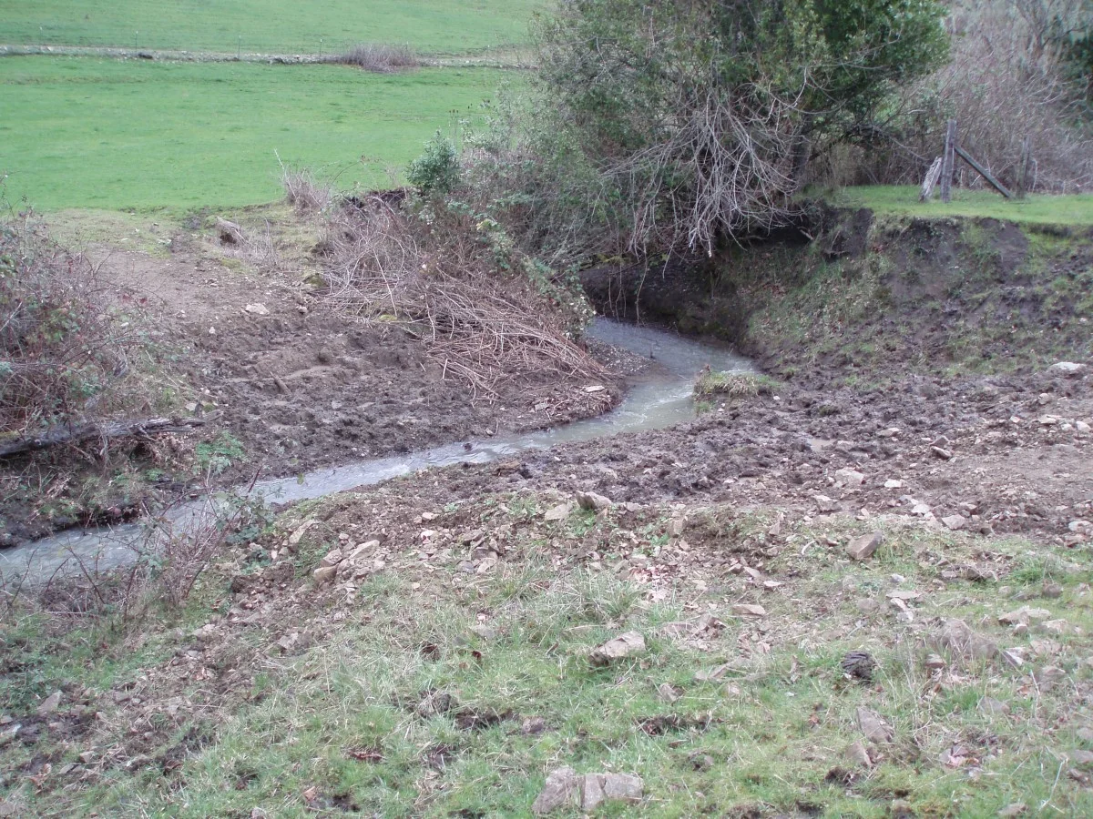
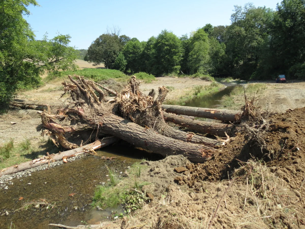
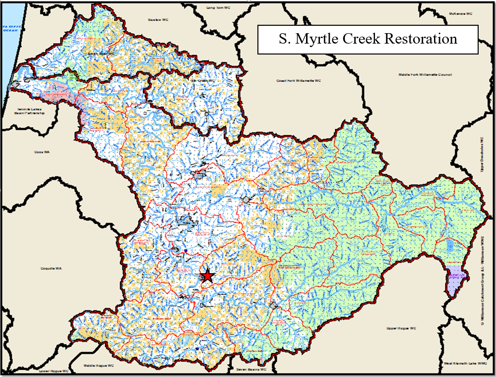
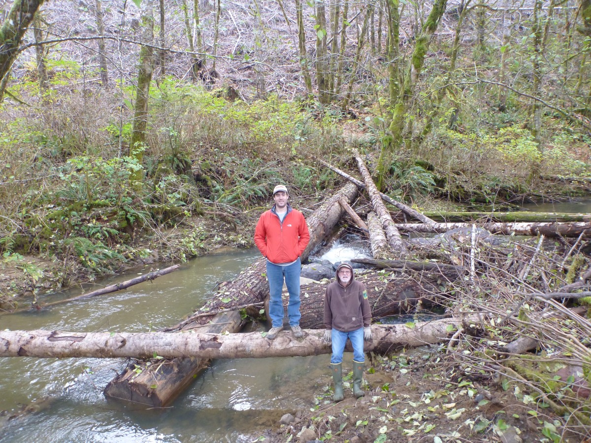
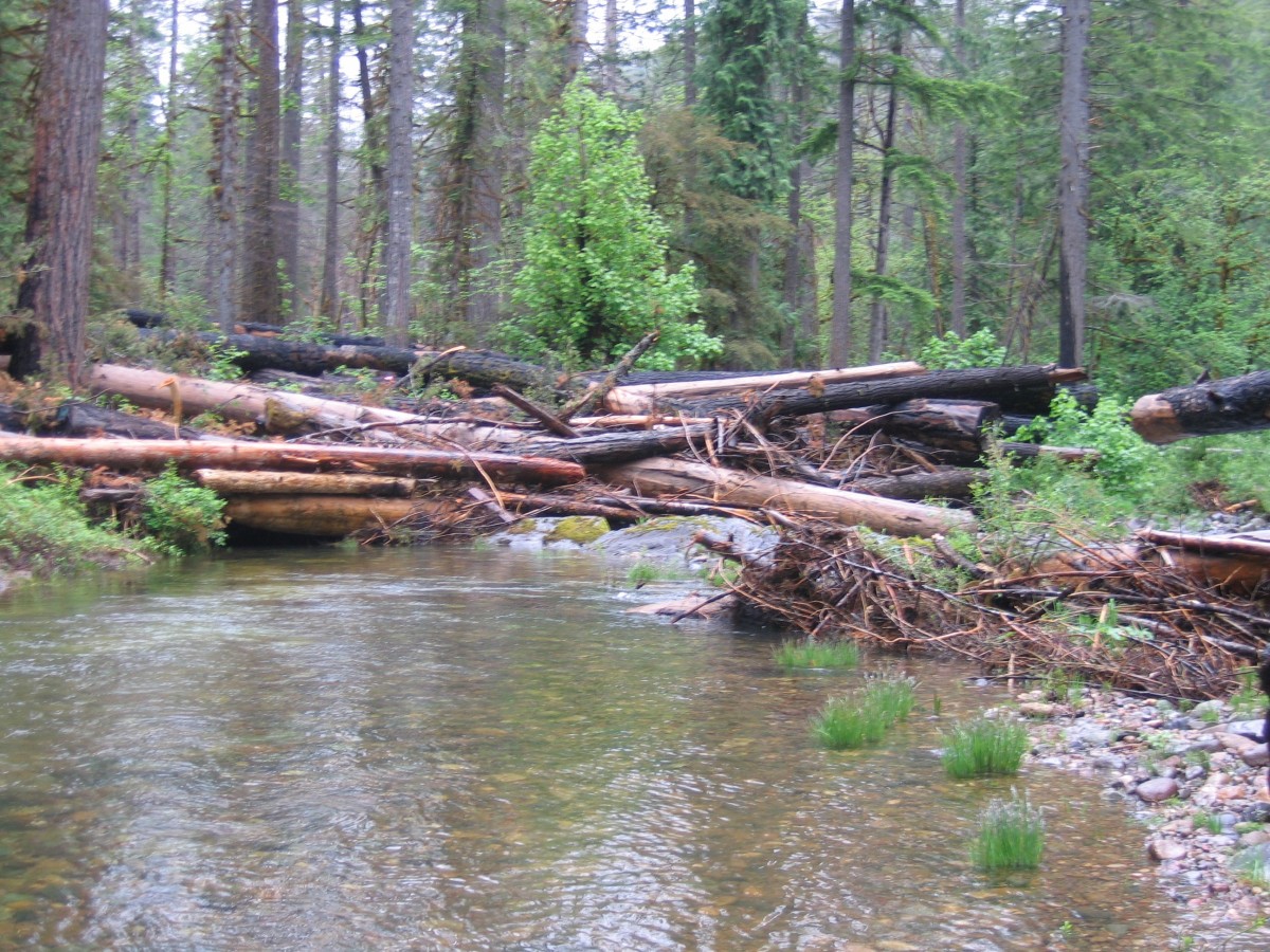
The purpose of this project is to strategically identify potential projects in stream reaches located on private lands that are in need of instream, riparian and fish passage restoration to re-establish historic coho salmon habitat in the Myrtle Creek Watershed. The watershed is a high priority within the Umpqua Basin for instream and riparian improvement because of the high intrinsic potential (HIP) for coho salmon production identified by ODFW and BLM. Other species in the watershed include winter steelhead and fall Chinook salmon, resident and sea-run Oregon Coast cutthroat trout, Pacific lamprey, chub, dace, suckers and shiners. Due to many historic and some current land use practices, much of the instream and riparian habitat is degraded. The numerous problems contributing to poor stream and riparian function and declining fish populations include lack of riparian trees, lack of instream habitat structure, poor fish passage through culverts, and water quality issues such as high bacteria and turbidity.
The goal of this project is to define stream reaches on private lands where restoration is needed. When the reaches are identified, PUR will use local meetings, mailings and phone calls to contact landowners and share information about the proposed project. PUR will conduct site visits to assess the stream condition on properties owned by the subset of landowners interested in pursuing restoration projects. Potential projects will then be prioritized based on the limiting factors known for the project’s area. Objectives include 1) creating maps to show where projects are needed based on fish presence, instream fish habitat condition, riparian condition and water quality, 2) conducting local outreach efforts, 3) performing site surveys to determine potential project designs and 4) prioritizing potential projects and pursuing funding for project planning and implementation.

South Myrtle Creek Restoration

South Myrtle Creek Restoration

Weatherly Creek Map
The tributaries of the Lower Umpqua River are among the most productive streams in the basin and the most important to coho. However, many have been severely impacted by practices that are now outlawed, such as splash damming and stream cleaning. The Partnership for the Umpqua Rivers and Oregon Department of Fish and Wildlife biologists have partnered with two private landowners to restore Weatherly Creek, a highly productive tributary to to Umpqua River. Cary Weatherly (great-grandson of the original homesteading family) and Roseburg Resources Co. have embraced the proposed restoration efforts on their lands. This tributary is low gradient, 20'-30' wetted width, bedrock dominated and has an intensively logged watershed. A lack of Large Woody Debris (LWD) and boulders has limited the spawning and rearing habitat, resulting in lower fish production than is potentially possible. This project seeks to use an excavator to place 1390 boulders, 120 cubic yards of gravel, 93 50' logs with rootwads, 16 50' logs without rootwads, and 15 40' logs throughout 37 sites. The project area begins at the Highway 38 bridge and continues 4.9 miles upstream.

Weatherly Creek Restoration

Weatherly Creek Restoration

weatherly creek 4.jpg

Weatherly Creek Restoration

Weatherly Creek Restoration

Jackson Creek Map
This project is planned for 7 miles of the mainstem of Jackson Creek, from Luck Creek Flat to LoneWoman Creek which corresponds to the best remaining habitat in Jackson and has greatest potential for significant benefits. Jackson Creek had extensive stream cleanout take place in the 1960's. Subsequent flood events (1964, 1974) caused extensive scouring of the stream channel to bedrock and loss of velocity refuges. Although damaged, this reach still has reminant floodplain connections, some good gravel accumulations and gets extensive use by spring chinook, winter steelhead and OC coho. The project involves restoring large wood to the stream channel in stable accumulations of 8-10 logs, many with attached root wads. Logs collected for this effort are up to 70 feet in length.

Jackson Creek Restoration

Jackson Creek Restoration

Jackson Creek Restoration


