
Bilger Creek Map
Bilger Creek is a tributary to North Myrtle Creek and is located approximately three miles northeast of Myrtle Creek in the Myrtle Creek fifth-field watershed. Bilger Creek provides important spawning and rearing habitat for coho, steelhead, cutthroat trout, and Pacific lamprey. However, large woody debris and habitat structures necessary for summer and winter fish survival are limited in Bilger Creek due to historic hydraulic mining, channel straightening, road building and stream cleaning practices. Water quality issues have also been identified in Bilger Creek by the PUR volunteer water quality monitoring program and include high stream temperatures, turbidity and E. coli levels. When a private landowner contacted PUR about restoration opportunities in Bilger Creek, the opportunity was seized to work in this creek and begin to address the limiting factors to fish survival. Project work will start with clearing the blackberry along the creek. The next stage is to place 80 logs and 200 boulders at 19 sites in Bilger Creek with an excavator. The final phase is to follow up with native plant establishment. A culvert, owned by Douglas County, that is a partial barrier to fish passage is located in the middle of the project site and will be targeted for future replacement.

Bilger Creek Restoration

Bilger Creek Restoration

Bilger Creek Restoration

Bilger Creek Restoration

Bilger Creek Restoration

Bilger Creek Restoration

Rock Creek Map
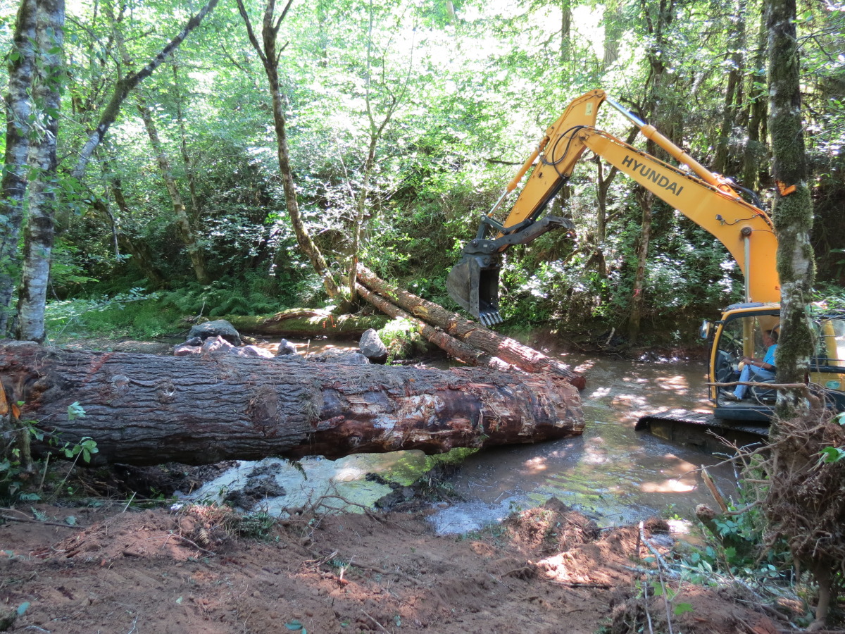
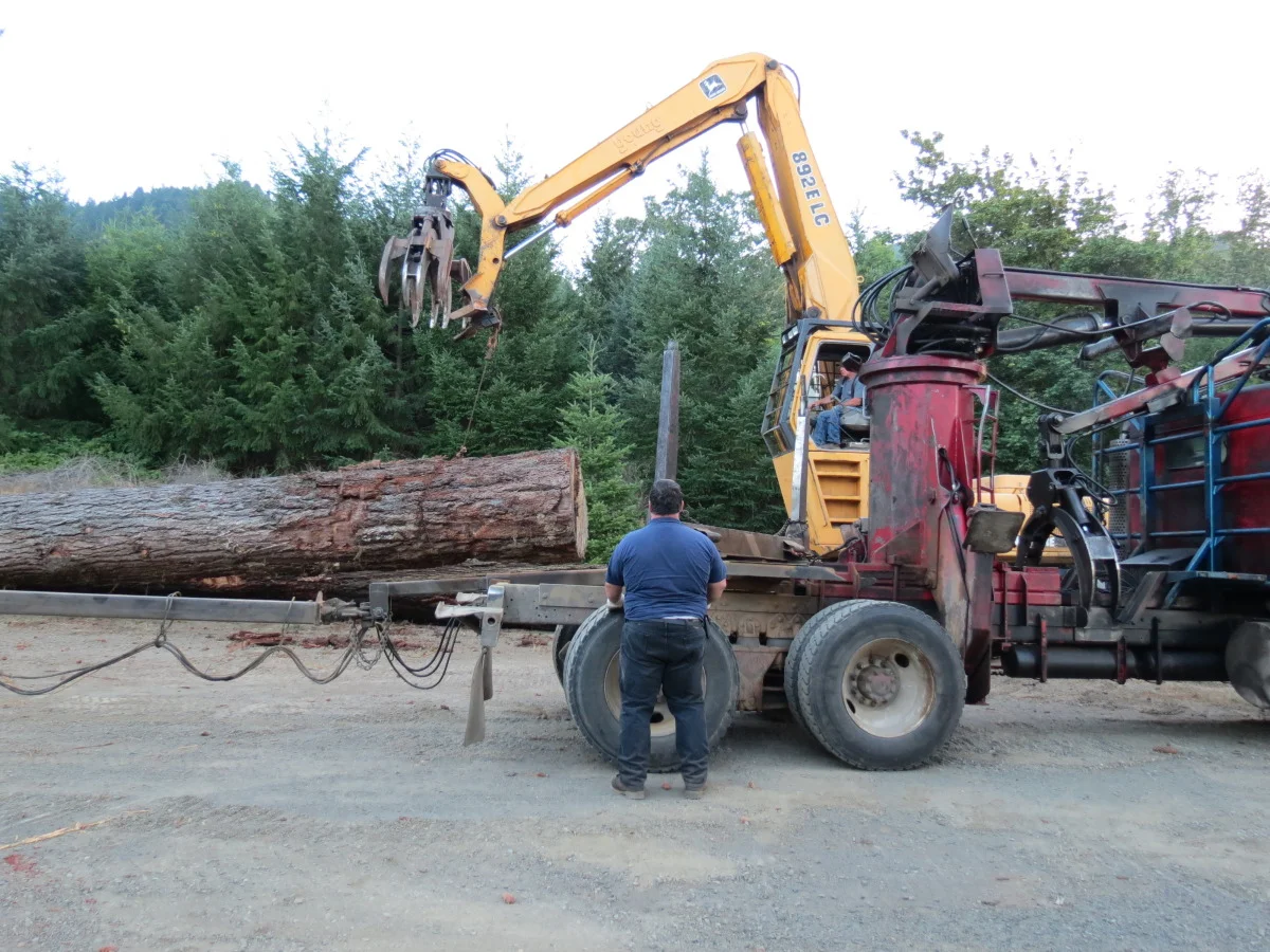
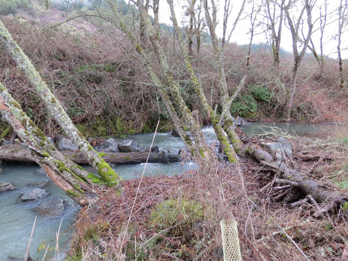
Rock Creek, one of main tributaries to the North Umpqua River, is a major contributor to OC coho, spring and fall Chinook, summer and winter steelhead, cutthroat trout and Pacific lamprey production. A new fish ladder, located at the dam near the mouth of Rock Creek, has greatly improved fish passage, but poor upstream habiat still limits fish production. In-place instream restoration projects are already working to increase fish survival. Restoration work planned for 2014 implementation will occur immediately downstream from already restored habitat and will include 1,400 boulders, 20 trees and 51 logs placed at 19 sites.
The long-term outcome of the Rock Creek Restoration Project is the restoration of historic runs of wild anadromous fish to the watershed. This will be accomplished through watershed-scale instream and side channel habitat restoration. This phase of instream restoration work includes the placement of 51 logs, 20 trees and 1,400 boulders throughout 19 sites in Rock Creek and will create specific habitats: slow flowing meanders, juvenile fish refuge areas, spawning gravels for spring Chinook, summer steelhead and coho, and deep pools for upstream migrating fish.

Rock Creek Restoration

Rock Creek Restoration

South Fork Deer Creek Map
The Hatfield Ranch is located near Roseburg Oregon along South Fork Deer Creek (SFDC). This family has been actively working to restore the creek on their ranch since 2007 when they entered a CREP contract for a portion of the ranch and placed logs and boulders in that section of the creek. Since then, two more highly successful phases of work have been completed and more than 200 logs and 300 boulders have been placed instream in SFDC. This application addresses the final phase of work where 97 logs and 435 boulders will be used to create high quality fish habitat in SFDC. Project work is just upstream from the highly successful Hall Ranch. This will benefit Oregon Coast coho salmon, winter steelhead, resident cutthroat trout, Pacific and brook lamprey and other resident non-game fish. The work will complete fish habitat restoration on the ranch. The outcomes expected from the project include the creation of high quality summer pool and winter high water refuge habitat.

South Fork Deer Creek Restoration

South Fork Deer Creek Restoration

Brush Creek Map
Brush Creek is a tributary to Elk Creek and is located approximately six miles east of Elkton in the Elk Creek fifth-field watershed. Brush Creek provides ten miles of spawning and rearing habitat for coho, steelhead, cutthroat trout, and Pacific lamprey. However, large woody debris and habitat structures necessary for summer and winter fish survival are limited in Brush Creek due to historic splash damming, channel straightening, road building and stream cleaning practices. The results from previous attemps at instream restoration in the watershed have been positive, but only cover a small portion of the available fish habitat. After an extensive basin-wide instream habitat survey of Brush Creek, the many other areas in need of restoration were identified as well as a previously undocumented beaver-created wetland complex. The two main landowners in the watershed, Lone Rock Timber Company and Roseburg District BLM, support a large-scale instream restoration project in Brush Creek. The first phase of this project will be to place 400 logs and 300 boulders at 55 sites in Brush Creek with an excavator.

Brush Creek Restoration

Brush Creek Restoration

Brush Creek Restoration

Brush Creek Restoration

Days Creek Map
Streams throughout the Days Creek – South Umpqua River watershed have the potential to provide high quality spawning and rearing habitat for coho salmon, steelhead trout, and resident cutthroat trout. However, much of the riparian and in-stream habitat in the watershed is degraded. Over the past five years, the BLM and the Partnership for the Umpqua Rivers (PUR) have completed several restoration projects, including culvert replacement to restore fish passage and placement of logs in streams to improve fish habitat, but many opportunities for restoration remain. The land ownership in this watershed is complex, consisting of a mix of industrial timber lands, individual private ownership, and BLM-managed lands. The BLM and PUR are cooperating to identify, plan, and conduct restoration projects across these complex ownership boundaries.
This project will involve the placement of logs in the stream to trap gravel substrate, dissipate stream energy thereby reducing erosion on banks, and enhance scour of deep pools. Most logs will be placed in stable pinches between standing live trees in order to provide stable, long-term debris jams. Logs will be purchased from local landowners or industrial timber operators. Logs will be placed in the stream using an excavator in accumulations that mimic naturally occurring debris jams. Excavator access trails will be seeded and mulched once the project is completed to reduce the footprint and the opportunity for invasive plant species to colonize the area.

Days Creek Restoration

Days Creek Restoration

Days Creek Restoration


